Vacquières
• Hérault (34270) • Population: 294 • Altitude: 70 m
Gallery of 9 photos for Vacquières
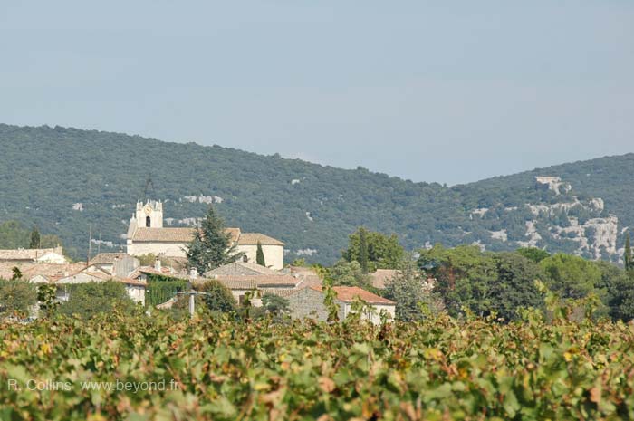
Vacquières is a small farming village set amidst vineyards and garrigue about 30 km west of Nîmes.
Some of the walls of the stone buildings in Vacquières are covered in thick climbing plants, making a picturesque sight [Photo-04].
Village commerce consists of a daily market [Photo-03] and the mobile butcher's van that stops beside the main square.
Vacquières hosts a good terrace café-restaurant [Photo-06]. They also sell an excellent red wine, in small competition to the winery that's located inside the village, just next door.
Pont des Cammaous
The "Roman bridge" (pont romain) 1 km southeast was actually built in the 12th century. It's a pretty bridge, out across the vineyards at the edge of the woods [Photo-08 and Photo-09].
It's a 20-minute walk across the fields to the bridge, where a small river runs along the tree-line separating the vineyards from the woods. And there's a nice view back to the village. You can also drive out to the bridge along a country lane. A picnic table, nice shade and room for the kids to run around make this a good lunch spot.
History of Vacquières
Name
First record, 1151 Vacheriss
Prehistoric: Chalcolithic (Ages of Humankind ) sites were located nearby, at Fenouillet, Les Bastides, Le Clos du Mounier, Le Causse, Baramié, Lascot and Les Gardies. The sites at Baramié and Lascot also had tombs and steles.
Medieval: An act of the Viscount of Nîmes in 1151 mentioned the Castrum de Vacquières, stating that the lord of the territory was Rayond de Vacheriss.
In 1168 Jean de Montlaur created the hospital of Sylve Gautier, located near the Quatre Chemins du Patus to the southeast. The complex included the hospital, a church and a cemetery. It was eventually converted into a bergerie (sheep fold), but even that's been reduced to just a few stone walls.
The "Roman" bridge (pont romain) 1 km southeast was actually built in the 12th century. It's a pretty bridge, out across the vineyards at the edge of the woods.
More Recently: Vacquières had two glass works (verreries) until the middle of the 17th century.
Hiking
• GPS: 43.844636, 3.944953
Maps
IGN (1/25,000) #2742 ET "Ganges, St-Martin-de-Londres, Pic St-Loup"
IGN (1/25,000) #2842 O "Sommières"
The IGN maps don't show any marked hiking trails at Vacquières, but there are country lanes and dirt tracks out in the woods and garrigue that can be wandered.
Not too far away, the loop hike from Corconne (Corconne Hike) is only 3 km to the north of Vacquières, and there's a short hike 6 km to the west, at the Rocher du Causse near the village of Lauret.


