

Corconne Hike
Gallery of 14 photos for Corconne Hike
This is a 3-hour loop hike beginning (and ending) at Corconne village, including a side-visit to the ruins of the 12th-century castle on the edge of the overlooking cliffs.
Hiking
Maps
IGN (1/25,000) #2742 ET "Ganges, St-Martin-de-Londres, Pic St-Loup"
The hike begins beside the town hall (mairie), going north up the Chemin de la Vialate, a paved road that quickly becomes an unpaved lane [Photo-01].
Just a few minutes after clearing the village there's a great view of the medieval chapel in the castle ruins on top of the cliff [Photo-02].
[Photo-03 and Photo-04] show the trail up through the rift leading to the to of the cliff. The trail is rocky, but most of it isn't very steep, and there's good shade. And it's a environment.
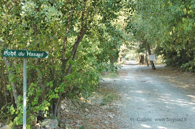
The rock formation called the Pont du Hassard [Photo-05] is only 20 minutes from the start.
It's another 15 minutes from the "Pont" to the plateau, where a stone cairn and hiking signposts mark a junction for the continuation of the loop or a side trip south to visit the Chapel in the Chateau Ruins [Photo-07].
We pondered whether we should continue on our loop hike "without loosing time", or take the scenic side trip to the chapel. We voted for the side trip, and were rewarded with an incredible, accidental meeting with this magnificent bird [Photo-11]. The trail out to the chapel also has some great views of the adjacent cliffs, as well as a great view out over the countryside to the southeast.
After a bit more than a half-hour we were back at the cairn/signpost junction to continue the loop. The next part of trail was pretty much level, but still in the shade of thick trees and high rocks [Photo-13].
An hour and a half after the start (including the half-hour side trip) we arrived at the "real" plateau, and the dusty forestry road that would be the trail for northern loop out across the low oak forest and scrub land. This Photo-14 is typical of the forestry road for an hour, before the trail turns south and then southeast and begins a gradual descent down from the plateau back to the village.
 After 25 years online, I've decided to remove all Ads from my one-man web Provence Beyond. If the content is enjoyable or useful to you, I would really appreciate your support.