Taulignan
• Drôme (26770) • Population: 1,589 • Altitude: 289 m
Gallery of 13 photos for Taulignan
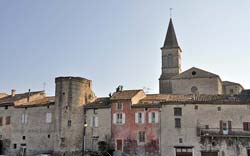
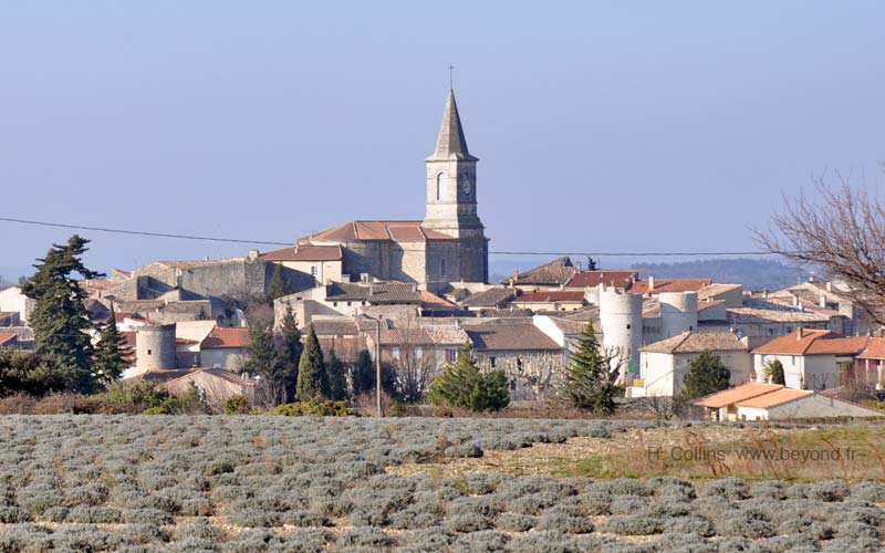
Taulignan in Medieval walled village in the Drôme Provençal, just north of the "Popes Enclave" and the village of Valréas. The village and its ancient defensive walls siit amidst the lavender fields and vineyards east of the Rhône river.
 The circular old village is very compact inside the ancient walls. The narrow streets, stone walls, old houses and doorways are completely in character with the historic origins. There are many facades from the 15th, 16th and 17th centuries.
The exteriour walls (ramparts) around the western half of the village still have the 13th-century towers. At the north side of the village, a pair of picturesque Medieval towers protect the fortified entrance, Porte Nord, into the interior of Taulignan. The eastern side of Taulignan still has the circular form, but the integral walls are no longer visible.
What can be considered the main village square is in front of the town hall (mairie), just outside the walls at the west side of the village. Here you'll find the post office and the silk museum.
Truffles
Taulignan is in the black truffle region, including Valréas and Richerenches. Arriving here on a Saturday in January, the first thing we saw was truffle sales being conducted from the back of a car, a common winter site in the truffle towns.
Weighbridge
 Early (such as 19th-century) weighbridges are often picturesque, and remind us of a more human-level commerce from an earlier era. This weighbridge in Taulignan, restored in 2004 with its original mechanism, was used from 1855 until 1984, and it had replaced an earlier model from 1834. The Taulignan weighbridge is located just outside the walls, near the Porte Nord.
This weighbridge was used to weigh whatever was being traded at the time, including wood, coke (of the coal variety), straw, grapes, mulberry leaves (for silkworms), flour, grain and potatoes.
Taulignan Silk Industry
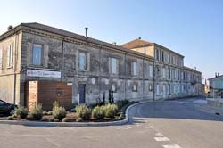
 A silk spinning industry in Taulignan brought it prosperity during the 19th century. The original silk-spinning building is still prominent today, at the west side of the village beside the Route de Grigan. Over 400 people once worked here. The building today honors the silk with a museum-workshop, adjacent to the town hall [Photo-07].
Invaders and Pilgrims
Taulignan was a transit point and meeting place for tradesmen, including weavers, masons, armorers, and such (see Weighbridge, above). During the 3rd to 5th centuries there were also frequent invaders passing through here. The visitors, benign and otherwise crossed the bridge over the Lez river (2-1/2 km east of the village) The river crossing is now called the Pont du Jas, and is on the Chemin des Invasions trail that leads to Taulignan.
This was also on the pilgrims' route to Compostela in the Middle East. In the 12th century, the Knights Hospitalers maintained here the Chapelle Saint Marcel, that served as a priory and leper colony.
History of Taulignan
Taulignan was possibly the site of a rich Roman patrician named Taulinanus. It was a fief of Baron de Montauban, ruled by Bertrand de Taulignan, until the 13th century. The fief was ceded to the Poitiers in 1295, and then a succession of other rulers until the French Revolution.
The castle of Taulignan, that filled a full third of the space inside the walls was destroyed in 1794 by order of the Convention.
Hiking
• GPS: 44.442673, 4.979679
Maps
IGN (1/25,000) #3039 ET "Valréas, Enclave des Papes, Pierrelatte"
The area directly around Taulignan is flat farmland, with lavender fields and vineyards. It's pretty, but not serious hiking country. There are some hiking routes, most following country roads, lanes and forestry roads.
A trail northeast from Taulignan goes into the low wooded hills bordering the Lez river; other than unmarked forestry roads, this would be an out-and-back hike.
East of Taulignan a trail follows the "Chemin des Invasions" about 2 km, then looping southwest to the monastery La Clarté Notre-Dame before returning north to the village; a total of 7 km.


