


Saumane (Gard)
• Gard (30125) • Population: 240 • Altitude: 327 m

Gallery of 6 photos for Saumane-30
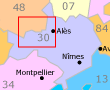
 See map
This little village of stone houses sits along both sides of a river flowing through the Borgne Valley, running between Saint Jean-du-Gard in the southwest and towards the Méjean Causse plateau to the northwest. Saint André-de-Valborgne has stone arched bridges, old fountains, and shady café and restaurant terraces.
The village buildings are attached end-to-end, with their fronts on the road and their backs to the mountain river passing through. A high, double-arched stone bridge is quite lovely.
A very low dam makes a very nice swimming area in the center of the village, with a more-or-less grassy berge for sunbathing. The swimming beach has a lifeguard every afternoon, and access is free.
Transportation Saumane (Gard)
Department 30, Gard Buses
- See Beyond's Gard Department Bus Schedules for Gard bus-lines maps and bus-line schedules (Horaires).
Maps (Plans) for the Gard bus lines are on the www.edgard.fr website, with a flash webpage for each of five zones around Nîmes (www.edgard-transport.fr/plan/?rub_code=5).
Schedules for the Gard bus lines are available via the www.edgard.fr website horaires page (www.edgard-transport.fr/horaires/?rub_code=23).
 After 25 years online, I've decided to remove all Ads from my one-man web Provence Beyond. If the content is enjoyable or useful to you, I would really appreciate your support.