

Roure
• Alpes-Maritimes (06420) • Population: 147 • Altitude: 1132 m

Roure is perched on the side of the mountain overlooking St. Sauveur from the northwest. You get up there by going north out of St. Sauveur (about 400 m) and turning left onto the D30 (Route de Roubion). The road goes up through several lacets (bootlaces, or switchbacks). You'll want to stop and look back down at the view of St. Sauveur at least once. After 4 km up the D30, turn right onto the D130, a very narrow road that winds its very twisted way another 5 km to the village. You will not find a lot of tourists up here, and you will have an incredible view down into the valley.
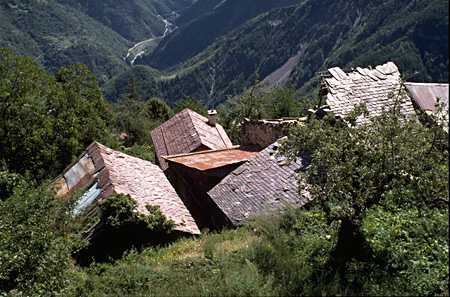
The road is lined with acacia and horse chestnut trees, and then lime trees nearer the village, giving good shade for cyclists. On the hillsides, the larch start appearing about half way up the small road. If you are walking, you will hear the sound of water all around. Small streams run over the rocks at the sides of the road as well as down the road itself. House roofs are made of a slate (lauzes) and some of the building walls are constructed from the dark red stone of the lower valley.
On weekends, the Boulangerie d'Eugène is open at the Four Communal de Roure.
Arboretum de Roure
The Arboretum de Roure is another 1.5 km beyond the village. This is an experimental site for the study of trees and bushes, both local and exotic varieties. This museum of trees is bordered by the Grande Randonnée GR5, so hikers who have climbed the 630 m vertical from the lower valley don't have to go out of their way.
Hiking
• GPS: 44.089908, 7.087467
Maps
IGN (1/25,000) #3641 ET "Moyenne Tinée"
Didier Richard (1/50,000) #9 "Mercantour"
A Gite d'Etape is located in Roure, down to the left just as you enter the village (along with the GR5 trail). Sign-posted 1 km outside the village, on the northern-most hairpin of the approach road (at 1025m) is Balise #243, Moyenne Tinée. This trail goes northeast up the valley and eventually joins the GR5.
The GR52A [GR] goes through Roubion, passing through St. Sauveur, St. Dalmas and St. Martin-Vésubie to the east, and Roubion, the Col de la Couillole (1678 m) and Beuil to the west.
- La Cerise, northwest of the village, at 1274 m.
- Roubion, the next village to the west. You follow the GR52A northwest along the Vionène valley (descending) about 5 km, where the trail turns back south and climbs to Roubion at 1247 m.
The GR5 goes north and then west, up through the Parc National du Mercantour.
- Refuge de Longon, 3hr. This refuge is in the Parc du Mercantour. Although the trail climbs from 1104 m to 1890 m, most of it is through forest, giving plenty of shade.
- Rougios and Puge are on the GR5 trail on the way to Longon.
- the trail to Tiecs and the Chapelle Ste Anne start at the same place, but branch off to the north of the GR5.
Other hikes sign-posted in the village include:
- Chapelle Saint Sébastien, 300 m. Just up the road is the 16th century chapel.
- Arboretum, 50 min. (described above)
- La Clauetta.
Mountain bike (VTT) trails are marked here as well: Forêt de la Fracha; Rougios; Refuge de Longon.