Gréolières
• Alpes-Maritimes (06620) • Population: 380 • Altitude: 810 m
Gallery of 14 photos for Gréolières
Gréolières is a pretty Medieval village perched on a ridge against the southern flank of the Cheiron mountain, in the hills 25 km north of Grasse.
Skiing | Ski France 2010-2011 Openings
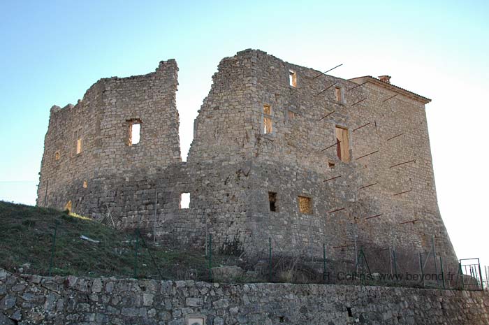
 Ruins of medieval castles (in upper village and lower village), ancient chapels, narrow streets and old buildings, Gréolières is small but interesting for a short walk-around visit.
The ruins of an even older village are on the hillside above the current village. It's only a short walk up the hill to explore these old ruins, and you'll have a good view down onto Gréolières.
The surrounding mountains and valleys make a magnificent setting for Gréolières. If you're driving through, you should stop just for a look around at the scenery, at the very least.
Gréolières village is a popular stopping place for hikers (summer) and skiers (winter), with a some basic commerce and a selection of café-restaurants.
Commerce
The Gréolières village tabac is in the center, at La Vieille Auberge café-restaurant. In the same part of the village is a good grocery store - bakery (épicierie - boulangerie)
There's a small chain grocery store, Vival, by the road junction to Cipières, 500 m east of the center of Gréolières.
At the main road at the top of the village is a brocante: roughly, a flea-market shop.
History of Gréolières
Name
First record, 1033 Graulearias
Prehistoric: There's a nearby prehistoric grotto, and a prehistoric shelter beneath a rock at Martin revealed tombs, vase fragments and a pierced boar's tooth used as a necklace.
Gallo-Roman: A Roman road once passed through Gréolières and out the valley to the west. A Roman milestone (borne milliaire) has been transformed into a roadside cross.
Medieval: The ruins of an Upper-Gréolières (Gréolières-Haute) are located just 300 m above the current village. The ruins of the upper village include the ruins of a 13th-century chateau, and the rebuilt 13th-century Romanesqe Saint-Etienne Chapel.
In the lower (current) village of Gréolières are the ruins of an older, 11th-century chateau.
Hiking

• GPS: 43.795524, 6.942929
Maps
IGN (1/25,000) #3642 ET "Vallée de l'Estéron"
The GR4 hiking trail passes through Gréolières. From the south, the GR04 comes up from Grasse, across the Plateau de Calerne and through Cipières village. To the north, the GR04 goes immediately up over the ridge of the Montagne du Cheiron (1380 m), past Gréolières-les-Neiges (1459 m), then northwest through the villages of Collongues, Amirat and Castellet-St-Cassien.
To the west from the village, a trail goes out the valley along part of the old Roman road to Le Fanguet. From there a loop is possible, back across the northern edge of the Calern Plateau, via Cipières village.
There are interesting, loop hikes east of Gréolières, some short, via St Pons or Cipières, or longer to Coursegoules.
Dining
There's a terrace-café at the top the village, with a good lunch menu for dining; photo-4 shows the terrace in the snow. This café is closed on Thursdays.
A couple of streets lower, in the center of the village, there are two good pizza restaurants (Le Cheiron, Place Pierre Meale; La Barricade, Place de la Fontaine), and a café-auberge (La Vieille Auberge) where we had a good daube de sanglier.
Sports
Skiing Gréolières-les-Neiges
The Gréolières-les-Neiges ski station is 4 km north of Gréolières village — 17 km by road. It's a popular ski station for its closeness to Grasse and this part of the coast.


