Eyguières
• Bouches-du-Rhône (13430) • Population: 5,483 • Altitude: 88 m
Gallery of 13 photos for Eyguières
Eyguières is a medieval village located in the hills at the eastern end of the Alpilles, between St Rémy-de-Provence and Salon-de-Provence. It's a working town more than a touristic place, but with a good feeling of year-round life in a small French village. Even on a winter Sunday, we found several bakeries and cafés open and streets full of people walking, shopping, talking.
Walking to the ruins of the castle at the top of the village gives you a nice view across the rooftops and across the surrounding countryside.
Efforts have been made to "improve" the castle ruins, but they've gone a bit overboard with the cement-works Theatre de Verdure.
Fountains are a feature of Eyguières, a town named after them. The 19th-century Fontaine à la Coquille [Photo 7] is actuallly sitting astride a canal running through the town.
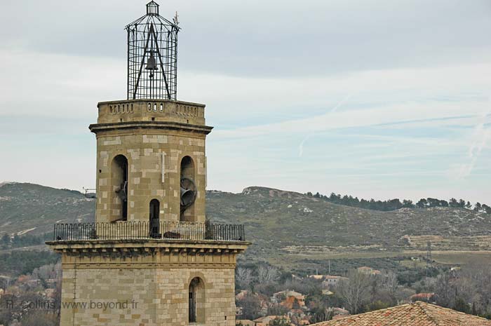
The Notre-Dame-de-Grâces church in the center of the village started life in the 11th century as the Sainte Marie Madeleine church. It was rebuilt in 1345 under the patronage of Notre-Dame-de-Grâces. Even after several stages of change and enlargement, the Archbishop of Avignon,in 1757 thought it was too small. The completely new church was built on the site, completed in 1783. A key feature in the church today is the 1802 organ once played by Frédéric Chopin.
Some nearby sites clearly worth visiting are the ruins of the Chateau de la Reine Jeanne north of the village and the archeological excavations of Saint Pierre de Vence about a km west of Queen Jane's castle.
History of Eyguières
Name
First record, 11th century Castrum de Aqueria: named after the fountains.
Prehistoric: Prehistoric occupation at Eyguières included prehistoric grottos at Sainte-Cécile and at Saint-Cerf (although we couldn't find either on the IGN map). Tombes were discovered in the Vallon des Vignes.
Gallo-Roman: Many signs of Gallo-Roman occupation have been discovered here. A Gallo-Greek necropole was on Mont Menu, at the western side of the village. A Gallo-Roman villa has been exposed at Saint-Pierre-de-Vence, 3 km northwest of the village. The Aurelian Way ran south of the village; the "Archimbaud" milestone was found 6 km southwest of Eyguières, just past the (non-Roman) aerodrome and the karting track.
Medieval: A priory was founded here in the 11th century. Co-ruled by the Cadenet and the Lamanon until the 14th century, then passed to the Sade from the 15th century until the Revolution.
Hiking
• GPS: 43.696223, 5.030313
Maps
IGN (1/25,000) #3143 OT "Salon-de-Provence, Miramas"
The GR6 Hiking Trail passes through the center of Eyguières, going through town on the main north-south street.
From the north end of town, the GR6 goes east over the wooded mountain of Défens d'Eyguières and the village of Lamanon before continuing south and then east towards Vernègues and Alleins.
From the south end of Eyguières the GR6 goes west through the village of Aureille, north through the hills to Eygalières (not the same village as Eyguières) and then west through the Alpilles.
There's a short (1hr30 round trip) hike from the center of Eyguières to the 12th-century of Chateau de la Reine Jeanne north of town. To get there, take the main road northeast (Rue Jean Bayo) out of town until it crosses a small stream. Turn left onto Chemin des Frères Mineurs and follow it north to the T-junction end. Continue straight on, on the yellow-marked trail, to the hill-top chateau.
Transportation Eyguières
Department 13, Bouches-du-Rhône Buses
- See Beyond's Bouches-du-Rhone (13) Bus Schedules for downloading Bouches-du-Rhone bus-lines map and bus-line schedules [pdf for each line] (link for PDF files).


