


The Causse du Larzac is a limestone plateau south of the Massif Central and about 50 km northwest of Montpellier. The Causse du Larzac is sparsely inhabited, used mainly for grazing sheep, and has a remote and desolate feeling.
These four menhirs, 1.3 km south of the tiny hamlet of Le Coulet, are in open fields and very visible from the D130 road that passes through. The ancient standing stones are around 3 meters tall, and shaped from pointed ovals (giant almond) to very narrow.
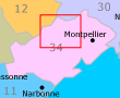
 This map (from the IGN's Geoportail website) shows the location and positions of the menhirs. The numbers (1-4) are our own.
Menhir 1 location: 43.810271,3.522555
Menhir 2 location: 43.809832,3.518894
Menhir 3 location: 43.808661,3.519246
Menhir 4 location: 43.807284,3.511607
Continuing south from here on the D130, the Ferrussac dolmens are only 5 km further on.
 After 25 years online, I've decided to remove all Ads from my one-man web Provence Beyond. If the content is enjoyable or useful to you, I would really appreciate your support.