

Cesars Camp Laudun
Gallery of 13 photos for Cesars Camp Laudun
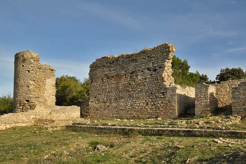
Cesar's Camp (Le Camp de César) was a small, fortified hilltop town containing a forum, a basilica and a tribunal. This walled camp was built by the Romans on the site of a 5th-century BC Gauloise oppidum, and was inhabited contiunally from the 5th-c BC until the 6th-c AD.
Laudun-l'Ardoise | Cesars Camp | Cesars Camp Map |
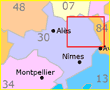
Cesar's Camp is in the commune of Laudun-l'Ardoise in the Gard, located about 20 km west of Orange and 10 km southeast of Bagnols-sur-Cèze.
Access
A parking area with shady picnic tables is located 1100 meters up a small road north-northwest of the Laudun-l'Ardoise village. From the parking area, a wide, cemented path goes another 600 m up to the Camp.
An alternate path to the Camp begins northwes of the parking area, where it branches off the GR42A, climbs east and follows around the south edge of the plateau. This is a narrow hiking trail rather than a wide, cemented path, and passes some great vista sites along the way.
Map of the Gallo-Roman Site
 Our map of the Cesar's Camp site near Laudun-l'Ardoise is from an information panel at the site.
Blue: depicts the walls of the Gauloise oppidum in the 5th century BC.
Purple: the Augustine period, with the round tower and thick entry walls
Red: Upper Roman Empire in the first century AD, which includes the Basilica, Forum and most of the "town" ruins.
Grey: foundations remaining from Late Antiquity, up to the 6th century AD.
Hiking
• GPS: 44.119376, 4.65485
Maps
IGN (1/25,000) #2940 OT "Bagnols-sur-Cèze, Pont-St-Exprit, Forets de Valbonne et"
 The hiking signpost (photo) at the parking area just below the hilltop site gives an idea about the variety of local trails in this area. Eleven destinations are listed, from the Balouvière Aqueduct (0.9 km) to Bagnols-sur-Cèze (7.6 km).
 The GR42 (Grande Randonnée) passes through Laudun-l'Ardoise village, goes up the small road to the parking area, and continues over the forested plateau (but not directly past the Camp).
Just past the parking area, the GR42 curves east across the plateau and drops back down to the plains at the village of Orsan, then continues north up the west side of the Rhône.
The GR42A crosses the west side of the plateau and goes north to Bagnols-sur-Cèze.
 After 25 years online, I've decided to remove all Ads from my one-man web Provence Beyond. If the content is enjoyable or useful to you, I would really appreciate your support.