

France Map Detail GR Montmirail
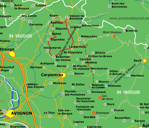
The solid red line is the GR de Pays de Montmirail.
The dashed red line is an alternate trail, also marked on the IGN maps as "GR de Pays".
IGN map #3040 ET (Carpentras) covers the main trail, west of Malaucène.
IGN map #3140 ET (Mont Ventoux) covers the alternate trail, east of Malaucène.
 After 25 years online, I've decided to remove all Ads from my one-man web Provence Beyond. If the content is enjoyable or useful to you, I would really appreciate your support.