

Malpasset Dam Photo Gallery

1/7. The "Reyran" river well below the dam. The "Reyran" river from the parking area, a few hundred meters below the dam.
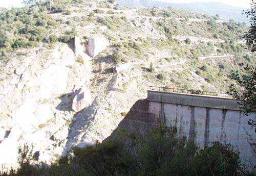
2/7. View towards the left bank from below the dam - View towards the left bank from below the dam; the top edge was the left of the two white blocks at the upper-right of the photo.

3/7. Viewed from below the dam - Viewed from below the dam; part of the left-bank structure, with the top walkway, is visible in the shade at the far left of the photo.
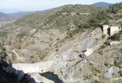
4/7. Viewed from above the dam - Viewed from above the dam, with the remaining right-bank structure in the foreground shade.

5/7. Looking up at the right-bank ruins - From below the dam at the bottom, looking up at the right-bank ruins; the top walkway is at the upper-left.

6/7. The remaining ruins of the left-bank of the dam - From below, looking up at the remaining ruins of the left-bank of the dam; the closest block of concrete, with the top surface foremost, is about 10 m long.
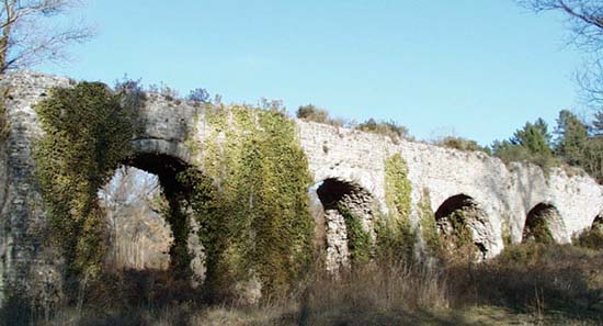
7/7. Roman aqueduct - A section of Roman aqueduct at the east side of the autoroute, less than 1 km downstream from the ill-fated Malpasset dam.
 After 25 years online, I've decided to remove all Ads from my one-man web Provence Beyond. If the content is enjoyable or useful to you, I would really appreciate your support.