

Hiking Maps Gard

A great set of maps are available for the different areas of the Gard department, from the Cevennes in the west to the edge of Orange and Avignon in the east, and including Alès, Nîmes and Aigues-Mortes on the coast.
Hiking Clubs | Hiking Guidebooks | Hiking Maps | Hiking Maps Gard | Hiking Maps IGN iPad | Grandes Randonnées | Mercantour Raid | Preparation | Topo Guides | Train des Pignes Hikes | Where to Hike |
The map part of the map shows roads, trails, points of interest, including mills, roman sites, special fountains, capitelles, chateaux and on and on. The map is colored as a 3D relief, indicates altitudes and specifies the length of trail segments.
 In addition to the map part, there's also an information block for each of the towns and villages in that area. Each has a description of a short day-hike (usually from one to 4 hours) as well as historical and visiting information for the village and the area. Information is also given for off-road cycling, horseback riding and other things specific to that area.
The complete map is printed on both sides. All information text is printed on one side in French and the other side in English.
We use these maps ourselves, and highly recommend them.
You can purchase them from the newspaper-magazine shops (papeteries) in the towns and villages of the Gard department.
Anduze
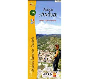 Autour d'Anduze - Porte des Cévennes. (scale 1:25,000)
Includes several sites around Anduze, such as the Dolmens of the Grande Pallières, Capelan, Tour de l'Arbousset, fortification ruins of Peyremale; Générargues; Tornac village and the Chateau de Tornac.
Cévennes, Vallée de la Cèze
 Cévennes et Vallée de la Cèze - Autour des Fumades-les-Bains. (scale 1:25,000)
Includes Allègres-les-Fumades, Méjannes-le-Clap, Navacelles, Potelières, Rivières, Rochegude, St Denis, St Jean-de-Maruéjols, St Privat-de-Champclos, St Victor-de-Malcap, Tharaux.
Lussan
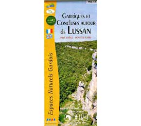 Garrigues et Concluses autour de Lussan; Pays Uzège - Pont du Gard. (scale 1:30,000)
La Bastide-d'Engras, Belvezet, La Brugière, Fons-sur-Lussan, Fontarèches, Lussan, Pougnadoresse, St André-d'Olérargues, St Laurent-la-Vernède, St Marcel-de-Careiret, Vallérargues, Verfeuil.
Rhône to Gardon
 Entre Rhône et Gardon - Autour du Pont du Gard; Pays Uzège - Pont du Gard. (scale 1:30,000)
Aramon, Argilliers, Castillon-du-Gard, Collias, Comps, Estézargues, Fournès, Meynes, Montfrin, Pouzilhac, Remoulins , St Hilaire-d'Ozilhan, St Bonnet-du-Gard, Théziers, Valliguières, Vers-Pont-du-Gard.
Uzès
 Collines et Vignobles autour d'Uzès; Pays Uzège - Pont du Gard. (scale 1:30,000)
Aigaliers, Arpallargues-et-Aureilhac, Aubussargues, Baron, Blauzac, Bourdic, La Capelle-et-Masmolène, Collorgues, Flaux, Foissac, Garrigues-Ste-Eulalie, Montaren-et-St-Médiers, St-Dézéry, St-Hippolyte-de-Montaigu, St-Maximin, St Siffret, St-Victor-des-Oules, St-Quentin-la-Poterie, Sanilhac-Sagriès, Serviers-et-Labaume, Uzès , Vallabrix.
Other Carto-Guides
Other "Carto-Guides" hiking maps available for the Gard are:
- Beaucaire Terre d'Argence
- Cévennes et Garrigues
- Cèze et Ardèche
- Garrigues en Costières
- Massif et Gorges du Gardon
- Le Val de Tave
- Vallée du Vidourle (Sauve - Quissac)
 After 25 years online, I've decided to remove all Ads from my one-man web Provence Beyond. If the content is enjoyable or useful to you, I would really appreciate your support.